Rainfall Accumulation, Rainfall Intensity and the role of New European Standards
Introduction
|
On 19 August 2019, European Standards were released detailing “the measurement requirements and classification of rainfall intensity measuring instruments”. The British Standards Institution (BSI) formally recognised this Standard on November 6th, 2019 by publishing an identical text under the auspices of BSI (2019). The document highlights international efforts to deliver an important step change in classifying the accuracy and integrity of rainfall intensity measurements, which are often poorly understood by consumers of rainfall data more accustomed to dealing with rainfall accumulation measurements.
|
What do the Standards Involve?
The new standard outlines a consistent process for classification of catching-type rainfall intensity gauges under laboratory conditions. It will allow users to buy and use a rainfall intensity gauge knowing that it will perform to a specific class of performance before it is deployed in the field. A rainfall intensity gauge shall be attributed a class of A, B, C or not classified based on how it performs when tested on a dynamic calibration rig.
The Rainfall Background: Accumulation versus Intensity
There are two primary quantities of interest when measuring rainfall: accumulation and intensity. Rainfall accumulation is historically the most common type of measurement and is typically reported in millimetres. It is useful in many applications, such as water resources management and traditional flood risk management practices. Rainfall accumulation is often measured over timescales ranging from 10-minute totals to monthly. Rainfall intensity is the rate at which accumulation occurs and is reported in mm/hr. In one sense, the intensity can be derived from the measurement of accumulation to produce an averaged rain rate, but this restrictive hypothesis assumes a constant rainfall over the accumulation period. It is not the same as performing a direct measurement of rainfall intensity.
Rainfall intensity varies greatly over short durations in time and space. Accurate quantification of this parameter requires measurements to be performed at a resolution of one minute, as is recommended by these new standards, where this quantity is referred to as “1-MIN RI”. Modern applications increasingly rely on real-time or near-real-time measurements of rainfall. For example, transport safety systems, urban hydrology and flood forecasting in flashy catchments all rely on fine resolution near-real-time rainfall intensity measurements in order to provide or help manage valuable services. Many of the same devices deployed to measure rainfall accumulation, such as the tipping bucket rain gauge, have the capability to measure rainfall intensity accurately. However, in the absence of any authoritative national or international guidance documents prior to the publication of these standards, such devices are neither calibrated appropriately, nor is the recording strategy adequate to return accurate measurements.
Rainfall intensity varies greatly over short durations in time and space. Accurate quantification of this parameter requires measurements to be performed at a resolution of one minute, as is recommended by these new standards, where this quantity is referred to as “1-MIN RI”. Modern applications increasingly rely on real-time or near-real-time measurements of rainfall. For example, transport safety systems, urban hydrology and flood forecasting in flashy catchments all rely on fine resolution near-real-time rainfall intensity measurements in order to provide or help manage valuable services. Many of the same devices deployed to measure rainfall accumulation, such as the tipping bucket rain gauge, have the capability to measure rainfall intensity accurately. However, in the absence of any authoritative national or international guidance documents prior to the publication of these standards, such devices are neither calibrated appropriately, nor is the recording strategy adequate to return accurate measurements.
Setting the Wider Context - Why are they necessary, and why now?
The Standards referred to in this article represent the culmination of nearly two decades of work undertaken by National Rainfall Laboratories in France, Italy and the Netherlands. Two rigorous intercomparison campaigns were led by the WMO-supported Lead Centre on Precipitation Intensity based in Genoa, Italy. The reports published from the laboratory and field-based intercomparisons provide the basis from which the European Standards were developed.
Understanding of the impact of climate change on rainfall patterns has progressed rapidly over the past two decades. The resulting effects of more intense rain events are being felt in many places around the world, causing an increase in damage and loss of life due to flooding from intense rainfall. This is one driver for the increased scrutiny on short-duration rainfall measurements.
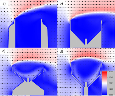
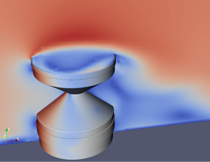
Without international standards directing how rainfall intensity measurements are quality checked, a legitimate concern can be tabled regarding the homogeneity and interoperability of current short-duration rainfall data from around the world. Therefore, when examining historical records great care must be taken to understand the method of data recording, the measurement technology and corresponding error profiles of the instruments used. If these are not properly accounted for, short-duration rainfall intensities may be underestimated or exaggerated with potentially adverse impacts on design criteria for urban development and flood defence schemes, for example. When unquantified environmental sources of error such as wind-induced undercatch are added to instrumental and calibration errors, there is an additional risk of degrading the quality of the data by an unknown extent (Pollock et al., 2018). Errors are inevitable when undertaking any measurement, but the most important issue is to understand the uncertainties that are introduced by the measuring process, so that they can be appropriately managed.
With rapid advances in sensor technologies, availability of crowdsourced personal weather station measurements and innovative methods of measuring rainfall as a by-product of another service, such as satellite links and car windscreen wipers, there is an opportunity to enrich information provided by existing rainfall networks with a greater depth of spatial and temporal rainfall data. When coupled with advances in data science and computing through machine learning and artificial intelligence, there is great potential to produce more useful rainfall products. However, there are huge challenges with collating, processing, verifying and validating such variable data sources, each having different error characteristics. The only way that this can be done effectively is to create and properly maintain as large a network as possible of reference quality instruments to provide highly accurate and precise rainfall measurements. This involves using the most advanced rainfall sensing technology, calibrated to the highest standards, located in a reference pit with the rain gauge orifice below the ground surface. Note that even with this ideal configuration, it remains critical to also have a strong understanding of residual errors and uncertainties.
Having made the case for a strong reference network, on the other side of the coin there is also a necessity to evolve measurement practices to start to assimilate new information. This is particularly important in the context of more extreme rainfalls occurring over increasingly localised areas. The total combined area covered by rain gauges in the world is less than the size of a football (soccer) pitch (Kidd et al., 2017), so there is already a high (and increasing) probability that localised storms will not be detected by these devices. There is a resulting demand for additional spatial rainfall information, even if the rainfall quantities measured by different technologies are subject to significant errors. The impact of improving the spatial extent of rainfall measurements on life-saving applications such as flood warning is likely to be significant, so it is critical that greater effort is invested in mining other sources of data to yield useful rainfall information.
How are EML dealing with the challenge?
EML collaborated with the Lead Centre on Precipitation in Genoa, Italy, to produce a laboratory dynamic calibration system. As far as we are aware, this is the only such system which exists in the UK. This enables rigorous calibration and classification of many different types of rain gauge i.e. not only those manufactured by EML. If you would like to have your rain gauge calibrated using the calibration rig, please get in touch with us directly to discuss your requirements.
The Standards make it clear that there is no absolute requirement for all applications. i.e. Class A is not necessarily more appropriate for all applications than Class C. The focus is on selecting a classification which is appropriate for the application, based on the understanding that a more accurate Class A rain gauge will likely be more expensive to purchase and maintain than a Class C rain gauge.
At EML we believe that our customers should be able to have an open an honest look at the data produced by our rain gauges, which is why we are choosing to publish a series of technical notes of rainfall intensity calibrations (see next newsletter). These are freely available in the form of “family” calibrations, which can be applied by the user within their logger software. For each model of rain gauge, the family calibration is a generic calibration developed from a sample of three gauges. Greater accuracy in the form of Class A certification can be achieved by performing an individual bespoke gauge-specific calibration. EML offer this as a service for those users that require greater accuracy for particular applications. Please contact EML directly for more information about this service.
What does the future hold?
For those customers who wish to receive pre-corrected data to their datalogger or PC, EML are currently developing an internal electronics device to fit inside the rain gauge which automatically applies the correction and digitally outputs the corrected rainfall intensity data. This product will be released later in 2020.
References
British Standards Institution (2019) BS EN 17277:2019: Hydrometry. Measurement requirements and classification of rainfall intensity measuring instruments. Available at: https://shop.bsigroup.com/ProductDetail?pid=000000000030365611 (Accessed: 14 February 2020).
Kidd, C., Becker, A., Huffman, G.J., Muller, C.L., Joe, P., Skofronick-Jackson, G. and Kirschbaum, D.B., 2017. So, how much of the Earth’s surface is covered by rain gauges?. Bulletin of the American Meteorological Society, 98(1), pp.69-78.
Pollock, M. D., O'Donnell, G., Quinn, P., Dutton, M., Black, A., Wilkinson, M. E., et al. ( 2018). Quantifying and mitigating wind‐induced undercatch in rainfall measurements. Water Resources Research, 54, 3863– 3875. https://doi.org/10.1029/2017WR022421


